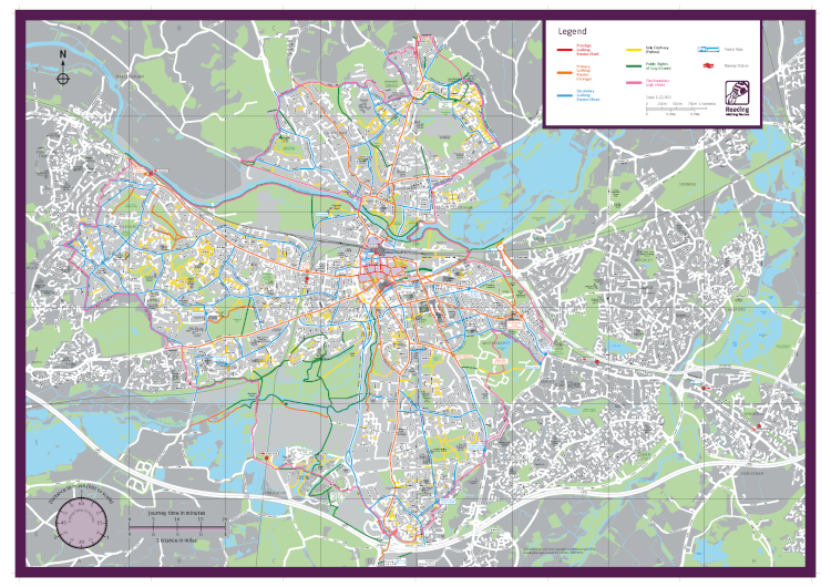
Walking network maps
Reading has a number of walking routes, which are colour-coded based on how busy they are and where they are located:
- Prestige walking routes (red) – busy areas in the town centre with high footfall and well-developed public spaces
- Primary walking routes (orange) – busy shopping streets in urban areas and main pedestrian routes
- Secondary walking routes (blue) -medium-use routes through neighbourhoods that connect to primary routes
- Link Footway (yellow)- low use, short estate roads to main routes
- Public Rights of Way (green) – footpaths that the public has a legal right to use
Walking maps
You can view or download walking maps of Reading using the links below
Reading walking map to download
Reading walking map and leaflet to download, with features that include an enlarged map of the town centre, a search function for street names and other useful information on places to visit in Reading.
Plan your route
You can also use the Reading cycle and walking routes interactive map to plan your route journey.
With the interactive map, you can:
- View all current walking and cycling routes
- Interact with routes to get more information
- Plan journeys by combining cycling and walking routes to key locations
Last updated on 02/10/2025
Walking network maps