Thames and Kennet walk
Download the Thames and Kennet walk leaflet
Length: 3 miles (5 km) walk or 4 miles (6.5km) longer walk
Duration: 1 to 1.5 hours (+ 30 minutes for longer walk)
Difficulty: Easy going. A flat route without major obstacles
Suitability: Accessible for wheelchairs, pushchairs and scooters. The extended route includes stepped access, and so is not wheelchair accessible.
Start: Rivermead Leisure Centre, Richfield Avenue, RG1 8EQ ///mile.legend.common
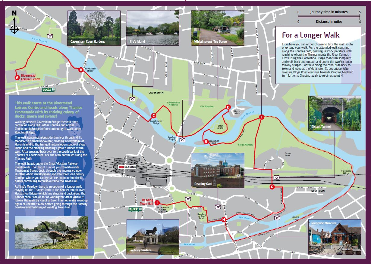
This walk explores riverside paths, open spaces and local landmarks. It starts at the Rivermead Leisure Centre and finishes at Reading Town Hall.
Route highlights
A. Start at Rivermead Leisure Centre and walk along Thames Promenade, home to ducks, geese and swans!
B. Walk under Caversham Bridge, then continue alongside the Old Father Thames to Christchurch Bridge.
C. Cross the river at Christchurch Bridge and walk under Reading Bridge through Hill’s Meadow.
D. Cross the footbridge at Heron Island to explore the peaceful green space at View Island and see the Reading Hydro turbines near the weir.
E. Return to the south bank via Caversham Lock, continuing along the Thames Path.
F. Under the Great Western Railway mainline through The Biscuit Tunnel.
G. Past the Riverside Museum at Blakes Lock.
H. Through the Huntley Wharf development.
I. Into town via Forbury Gardens, finishing at Reading Town Hall.
Optional extension
At King’s Meadow there is an option of a longer walk staying on the Thames Path to the Kennet mouth.
- A crossing over Horseshoe Bridge (this bridge has steps).
- A return along the Kennet Canal-side Path to Watlington Street.
- A reconnection with the main route near Reading Gaol at Chestnut Walk, continuing through the Forbury.
Places of interest on the Thames and Kennet route
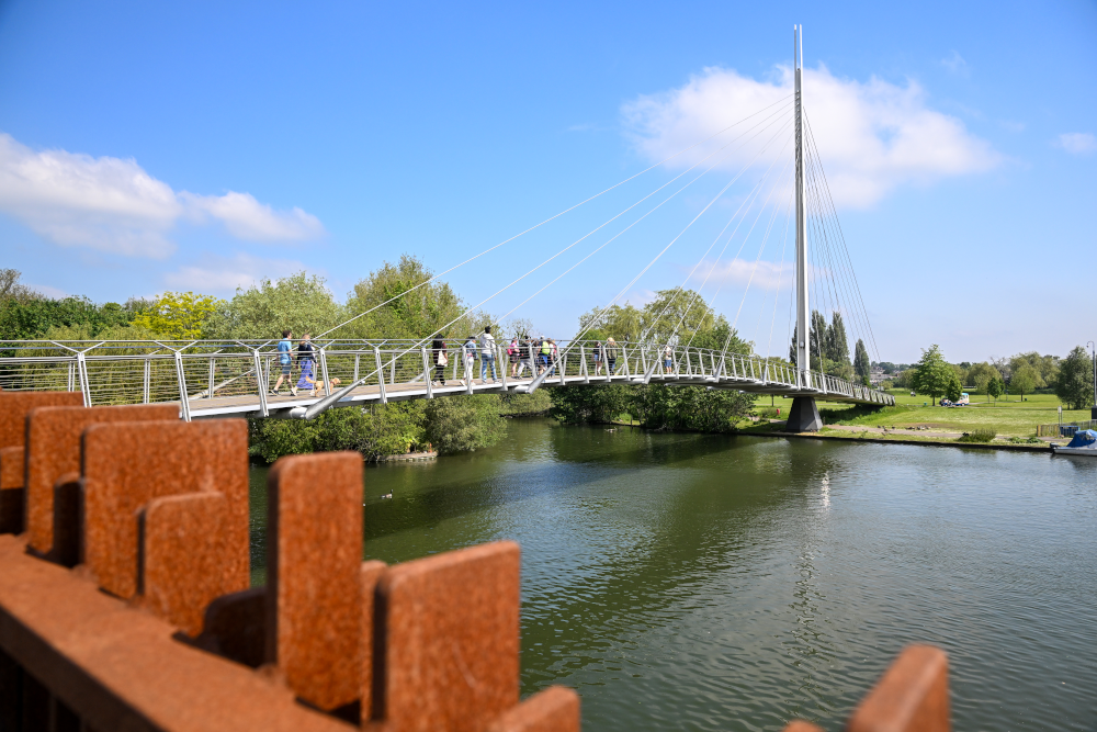
Christchurch Bridge
Christchurch Bridge is a traffic-free bridge for pedestrians and cyclists. It links central Reading on the south bank of the Thames with Caversham on the north bank. The bridge crosses the river 200 metres (660 ft) downstream from Fry’s Island. The bridge opened on 30 September 2015 and has won a commendation in the 2016 recognition of outstanding architecture, planning and design in the built environment.
Last updated on 08/09/2025
Thames and Kennet walk